WHAT IT IS
The Cheyenne Mountain Complex is the underground military installation built inside Cheyenne Mountain, on the southwest edge of Colorado Springs, Colorado. It was constructed between 1961 and 1966 (with final completion dated 1967 in some official accounts) to hold the combat operations center of the North American Air Defense Command, later renamed the North American Aerospace Defense Command (NORAD). Its job was simple to state and very hard to carry out: stay alive, and keep the warning and command functions running, through the first nuclear attack on North America. That meant a deep excavation in granite, a set of steel buildings that do not touch the rock, blast doors and blast valves, electromagnetic shielding, its own power, water and air, and a communications system with several independent paths out.
It is also one of the few hardened command posts of the Cold War whose existence, address and general layout were never secret. It has had public photographs, official fact sheets and (until recently) visitor tours for decades. That openness was deliberate. A deterrent only works if the other side knows what it faces, so the Americans advertised the mountain, while the Soviet side leaned on secrecy for its equivalents (see the comparison section below, and Perimeter).
The mountain is still in use. It is no longer the main NORAD and U.S. Northern Command (USNORTHCOM) day-to-day command center: since 2006 to 2008 that role has been at nearby Peterson Space Force Base. Cheyenne Mountain has instead been an alternate command center, a training site for crew qualification, and the home of the Missile Warning Center, whose watch has been manned in the mountain without interruption since 1966. It is managed today by Space Base Delta 1 of the U.S. Space Force, which is based at Peterson. The official designation is now Cheyenne Mountain Space Force Station.
This article is a reference page in the same style as the others on this site. It covers the history, the layout, the physics of why a hollowed-out mountain survives a nuclear burst, the communications that tied the mountain to bombers, missiles, submarines and the President, the backup power and life support, and how the complex compares with Soviet and Russian command posts. Everything here comes from public sources: NORAD and Air Force fact sheets, Government Accountability Office reports, a 1966 U.S. Bureau of Mines construction report, news reporting and published engineering knowledge. Where the public record is thin, contradictory or old, the text says so. The physics sections apply standard engineering to published figures, and where a number is my own estimate rather than a published figure, it is marked as an estimate.
QUICK FACTS
WHY IT WAS BUILT: NORAD AND THE BOMBER ERA
In the 1950s the United States and Canada faced a new problem: Soviet long-range bombers and, from 1957, Soviet missiles. The Soviet Union tested its first intercontinental ballistic missile in 1957 and launched Sputnik in October of that year. The two countries had already been building a joint radar warning network (the Pinetree, Mid-Canada and DEW lines) and the Semi-Automatic Ground Environment (SAGE) computer system to direct interceptors. In 1957 they set up a joint command, and the NORAD agreement was signed on 12 May 1958. The headquarters and its first combat operations center were at Ent Air Force Base in Colorado Springs, in a building above ground.
That building was the weak point. A command center that is supposed to warn the President and direct the air battle is also the first thing an attacker would hit. By the late 1950s the Air Force and the planners behind NORAD concluded that the center had to be hardened against nuclear attack. Other hardened Cold War command posts already existed or were under way, including Raven Rock in Pennsylvania (operating since 1953) and Mount Weather in Virginia (underground area completed in 1959); the Strategic Air Command also built its own underground command post at Offutt. Cheyenne Mountain was chosen because it sat in the center of the continent, away from the coasts and the first approach routes, had solid granite, little earthquake activity, and was close to Ent, the Air Force Academy and Fort Carson.
Two details of the official history are worth keeping in mind. First, the mountain was never NORAD's headquarters. NORAD's headquarters stayed on the surface (at Ent, then Peterson). What moved into the mountain was the combat operations center, the place where warning and attack assessment were done. Second, the original concern was bombers. The facility was conceived as a defense against long-range Soviet bombers, but by the time it opened the dominant threat was intercontinental missiles, and its mission quickly became missile warning and, from the late 1950s, tracking objects in space.
HISTORY: 1961 TO 1967
Planning and design
The design requirements were written down in the early 1960s, and they are unusually frank. The underground combat operations center was to have a 70 percent probability of continuing to function against a five-megaton weapon with a three-mile circular error probable, to be self-sufficient for brief emergency periods, to have backup communications and television intercom with related commands, to have limited but adequate sleeping facilities, and to be protected against fallout and biological and chemical agents. As the design matured, the performance criteria were tightened. Shock mounting of the interior buildings and protection against the electromagnetic pulse were added, all connections between buildings were to be flexible, and blast doors were required. The facility was ultimately designed to withstand a multi-megaton weapon at a range of about 1.5 nautical miles (2.8 km).
The popular "30 megatons at 1 nautical mile" figure is repeated in many secondary sources. I could not find it in the primary design criteria, and the figure I could trace to primary descriptions is the multi-megaton burst at about 1.5 nautical miles. This article uses the lower, documented figure. It is worth noting how loose these statements always are. "Withstand" is a probabilistic statement about a design specification and a particular weapon accuracy, not a promise.
Construction
The U.S. Army Corps of Engineers supervised the excavation. The Utah Construction and Mining Company was selected for drilling and blasting. The Bureau of Mines published a construction report in 1966 (Information Circular 8294, by Merwin H. Howes) that gives a detailed picture of how it was done. Controlled blasting was used to get smooth walls and to avoid shattering the rock beyond the excavation lines. The rock was then stabilized extensively: reinforced concrete and gunite (sprayed concrete) linings, rock bolts, chain-link fabric, and epoxy resin and cement grout. A particular zone of weakness at one vital location was supported by an exceptionally thick reinforced concrete lining, rock bolts and cement grout. Roughly 693,000 tons of granite came out of the hill between June 1961 and 1964 or so, and the buildings and systems went in after that.
The inner buildings were designed with naval shipbuilders' help. An Air and Space Forces Magazine article notes that the main work center "looks like the inside of a ship" because it was designed by Navy ship designers. The outer shell of each building is three-eighths-inch continuously welded low-carbon steel plate on a structural steel frame, and the same metal skin that makes them shock-tolerant and fire-resistant also makes them an electromagnetic shield. The Burroughs Corporation was selected in 1961 to build the electronics and communications system that would automate the evaluation of surveillance data.
Operational dates
The dates differ between sources, which is normal for a project that was finished in stages. The NORAD fact sheet gives groundbreaking as 19 June 1961, the Combat Operations Center as operational on 20 April 1966, and completion as 6 February 1967. The Peterson and Schriever Space Force Base page gives 6 February 1967 as the date of "fully operational". Some older accounts say excavation was finished in 1964 and the structure in early 1966. The honest statement is that the mountain was excavated from 1961 to about 1964, fitted out through 1965 and 1966, handed over for operations in April 1966, and formally completed in early 1967. The Space Defense Center moved in from Ent in 1967, and the National Civil Defense Warning Center was in the mountain by January 1967.
Robert E. Thibault, who worked the first night shift in 1966, remembered having to wear a yellow hard hat because bits of rock were still falling from the ceiling.
THE COLD WAR YEARS
The warning mission
From the beginning the mountain was a warning center. Sensors around the world (satellites, early-warning radars, ground radars and a network of civil and military reports) fed information to computers and displays in the mountain. Staff compared and assessed what they saw, and told the President, the Secretary of Defense and the Joint Chiefs what it meant. The official description of this role is a good one: "the brain stem". The sensors are the nerves, and the mountain is where the signals come together, are correlated and passed up to the people who decide.
The mountain also housed the NORAD Attack Warning System, the Space Defense Center (the catalog of objects in orbit), and eventually a number of centers and agencies: the Air Defense Operations Center, the Missile Warning Center, the Space Surveillance Center, the Weather Support Unit, the Intelligence watch, and the NORAD Command Center. By 1978 five operating centers and a command post were in the NORAD Combat Operations Center. The Space Defense Operations Center (SPADOC) was set up on 1 October 1979 to consolidate satellite survivability, space surveillance and anti-satellite operations in one place.
Computers, and the false alarms
The warning mission depended on computers, and the history of the mountain is also a history of those computers and their failures. The Cheyenne Mountain Complex Improvements Program, known as the 427M system, became fully operational in 1979. It had three major segments: a communications system segment, the NORAD Computer System, and the Space Computational Center. Its early performance was poor.
Three false alarms in 1979 and 1980 are well documented. On 9 November 1979 a training tape simulating a large Soviet attack was loaded onto a live system by mistake, and it showed up on operational displays; it was recognized as an error within minutes, and the best-known detail is that fighters were launched as a precaution and some national leaders were called. In June 1980 a failing integrated circuit in a communications multiplexer inserted incorrect numbers into the warning messages on two occasions, again producing false indications of a missile attack that were quickly resolved. A GAO report of 1981 (MASAD-81-30, "NORAD's Missile Warning System: What Went Wrong?") and a 1983 New York Times report by Richard Halloran describe the failures. About 6,700 messages an hour were being processed in those years. The lesson drawn was that attack assessment must always come from several independent sensor types, and that a human assessment (the "missile display" and "threat assessment" conferences) must sit between a sensor report and a decision. A system that fires on one sensor is a system waiting for a bad chip.
Later upgrade programs included Granite Sentry (to improve the NORAD Command Center, the Air Defense Operations Center, the Battle Staff Support Center and the Weather Support Unit, and to process nuclear-detonation data), the Cheyenne Mountain Upgrade of the late 1980s (a consolidation of five improvement programs, which ran into compatibility and specification problems and was not installed in its original form), and a 1995 modernization of the missile warning center that was part of a much larger renovation program.
The air defense side
In the 1960s NORAD's air battle was managed through SAGE, with the Back-Up Interceptor Control (BUIC) system as the fallback. The BUIC sites were radar and computer centers that could take over interceptor control if a SAGE direction center were destroyed or isolated, so that the battle could continue from smaller, scattered, semi-hardened places. This is general Cold War history and not specific to the mountain, but it shows the logic: the mountain was the top of a pyramid of redundant sites. The Joint Surveillance System, developed with Canada, replaced SAGE and became fully operational at seven regional operations control centers on 23 December 1983. Aerospace Defense Command was inactivated in 1980 as the bomber threat shrank and the missile threat grew.
THE MOVE TO PETERSON: 2006 TO 2008
By the early 2000s officials had concluded that the likelihood of a surprise ICBM strike against North America had fallen, that the main threats were now terrorism, hijacked aircraft and regional missile launches, and that running NORAD and the new USNORTHCOM (created after the September 2001 attacks) from two places was inefficient. In July 2006 the commander of NORAD and USNORTHCOM announced plans to move certain functions from the mountain to an integrated command center in Building 2 at Peterson Air Force Base. On 28 July 2006 the Cheyenne Mountain Directorate was redesignated the Cheyenne Mountain Division to help carry out the move. A Washington Post report described the underground center as being put on "warm standby", a phrase that has stuck.
The plan was controversial. A Government Accountability Office report (GAO-07-803R, May 2007) found that NORAD and USNORTHCOM could not document the savings of $150 to $200 million that had been projected, that they had not analyzed the operational effects, and that the security implications had not been fully assessed. Congress then required a report on the relocation, and a second GAO review (GAO-08-1054R) recommended a re-evaluation of the vulnerabilities of Peterson. The Department of Defense reported in 2009 that its security and vulnerability assessments were complete and mitigations were under way. The renovated Peterson command center was scheduled for occupation by the end of 2007.
On 12 May 2008, the fiftieth anniversary of the NORAD agreement, the command center in the mountain was formally redesignated the NORAD and USNORTHCOM Alternate Command Center, and the Cheyenne Mountain Division became a branch of the operations directorate. Many people believed the mountain had closed. It had not.
2015: COMMUNICATIONS AND WARNING GEAR MOVE BACK IN
The move to Peterson did not end the mountain's role, and the electromagnetic pulse threat was the reason. In March 2015 the Department of Defense announced a $700 million indefinite-delivery contract with Raytheon (FA8723-15-D-0001) to sustain the Integrated Tactical Warning and Attack Assessment (ITW/AA) and space support systems, with work at Cheyenne Mountain, Peterson, Vandenberg and Offutt. The contract notice says the program provides "accurate, timely and unambiguous warning and attack assessment of air, missile and space threats". Adm. William Gortney, then commander of NORAD and USNORTHCOM, told reporters that the department was moving to "put capability" back into the mountain because of the way it was built: it is EMP-hardened, and a lot of movement was under way to put capability into Cheyenne Mountain and to communicate in there. Defense News and Defense One reported that the staff inside the mountain would grow again, while the command center at Peterson would remain operational. Since 2013 the Pentagon had awarded more than $850 million in contracts related to the mountain, according to Defense One.
This shows something about hardening that is easy to miss. The mountain was designed in the 1950s and 1960s for a Soviet missile strike. The EMP part of that design was originally one effect among many. By 2015 the value of electronics, and the real fear that a single high-altitude burst could disable the unshielded electronics of an entire region, made the mountain's accidental EMP hardening one of its most valuable features. The Air Force said as much in 2016: "we are sitting here today as the number one rated EMP protected facility".
CURRENT STATUS
As of the most recent public material I could find (2023 to 2026):
The 2024 federal permit document also shows how mundane the maintenance is: the facility runs a heating, ventilation and cooling system, subsurface water and diesel reservoirs, a diesel-fueled power plant, cooling towers, drinking and wastewater systems, a groundwater dewatering system, air exhaust stacks and an interior storm drainage system.
SITE LAYOUT
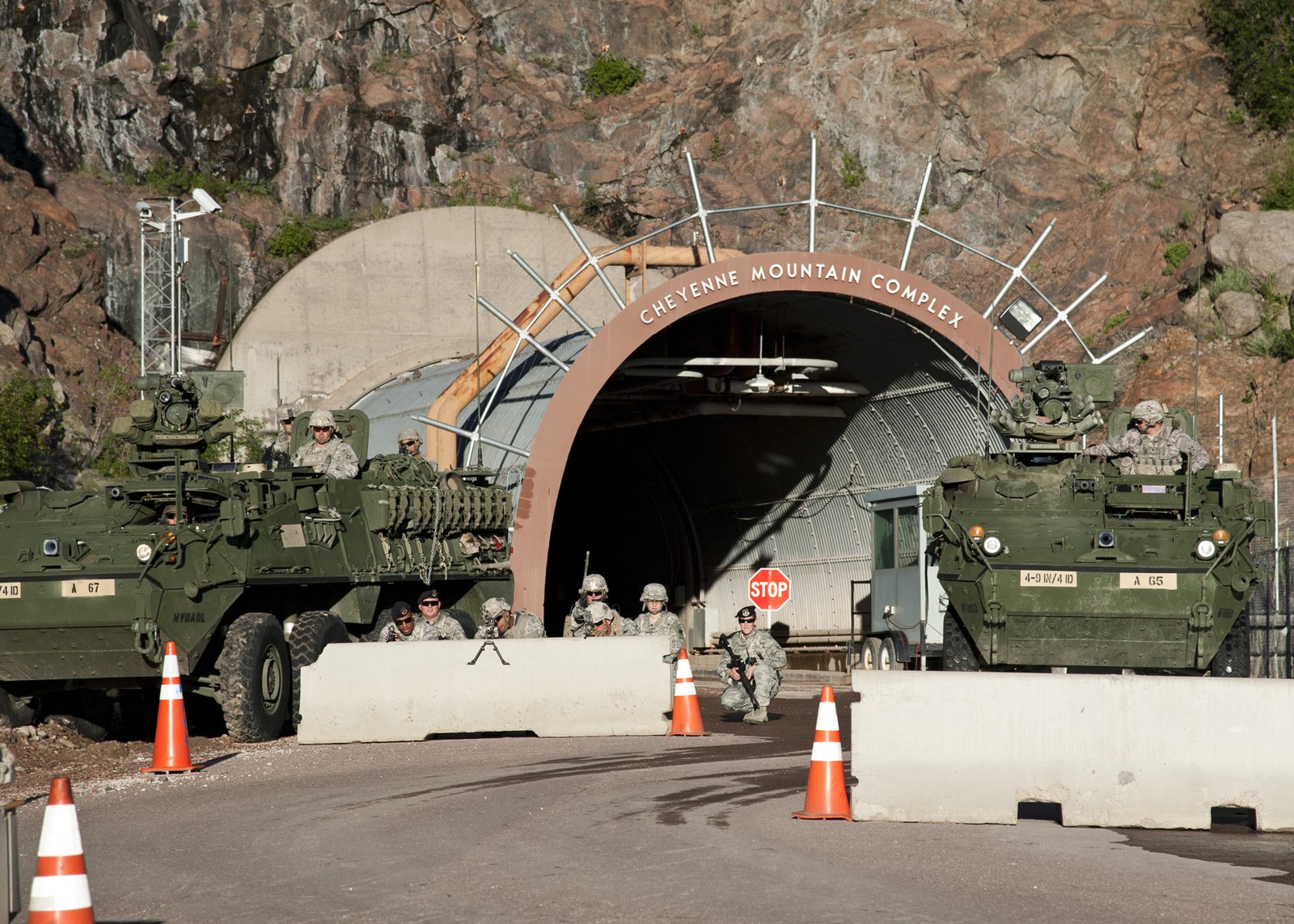
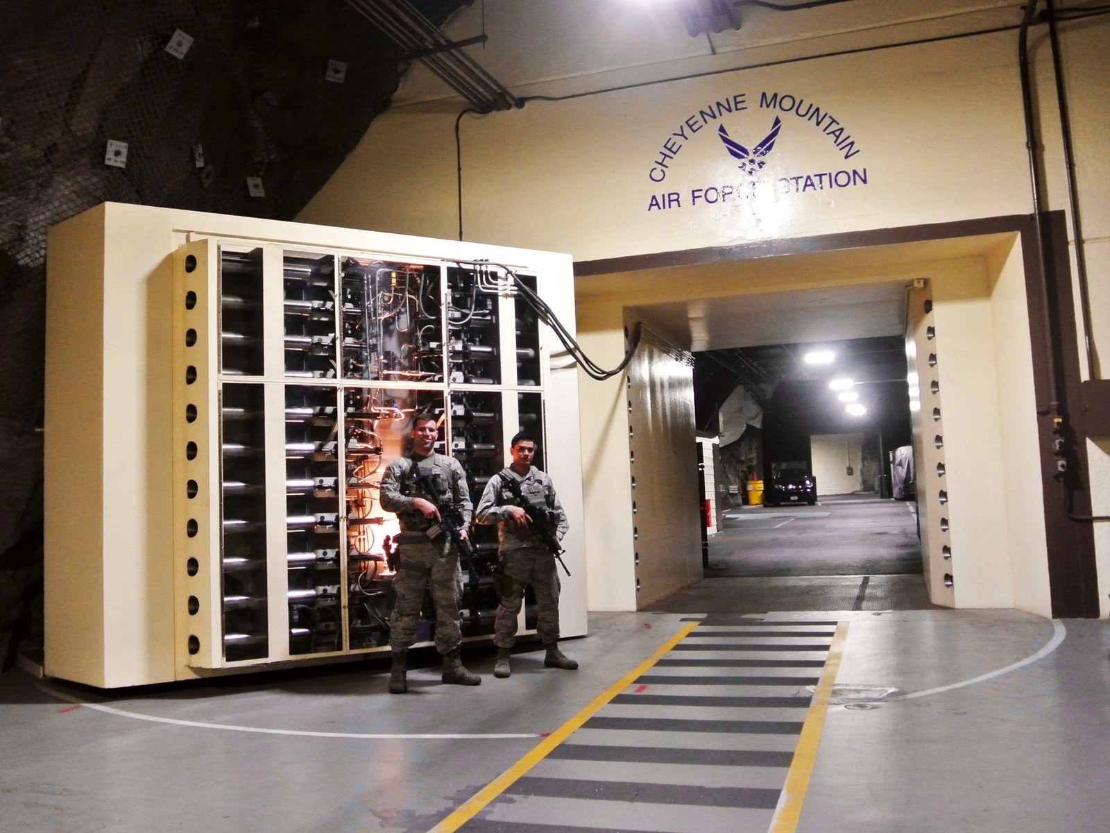
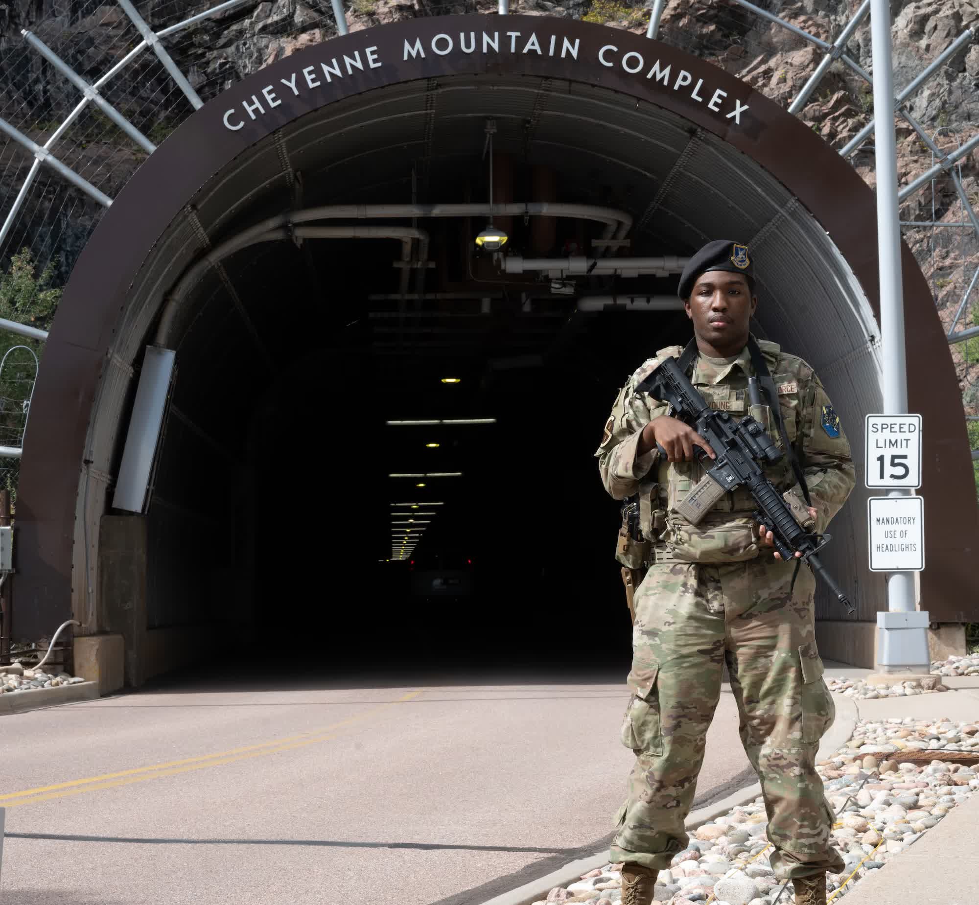
The mountain is entered through tunnels. The main entrance is about one-third of a mile (540 m) in from the North Portal. There is a South Portal as well, and sensors at both portals detect overpressure waves from a nuclear explosion and cause the blast valves to close. The tunnel from the North Portal leads to the pair of steel blast doors, and beyond them the tunnel meets the main chambers and the support area. A 1967 newspaper description notes that the main tunnel is meant to route the worst of a blast's shock out the other end. A tunnel layout with two entrances, bends and a long run gives the blast somewhere to go and reduces the pressure at the doors.
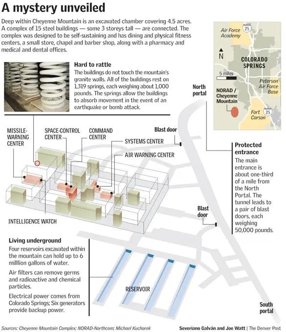
The excavation inside is a grid. Three parallel main chambers (45 ft wide, 60.5 ft high, 588 ft long) are crossed by four shorter chambers (32 ft wide, 56 ft high, 335 ft long). Inside these are the fifteen buildings, free-standing steel structures that touch neither the walls nor the roof. A Denver Post infographic prepared with NORAD and USNORTHCOM information labels the main work areas: the Missile-Warning Center, Space-Control Center, Command Center, Systems Center, Air Warning Center and the Intelligence Watch. Its figures differ from some other sources in small ways, and these differences are listed in a later section.
Outside the chambers, on the support side, are the water reservoirs, the diesel reservoir, the power plant, the cooling towers (some above the surface, some inside), the air plant and the utilities. Twelve of the buildings are three stories tall, and three are one or two stories. Inside the complex a dining facility, a medical facility with a dental office and pharmacy and a two-bed ward, two fitness centers with a sauna, a small base exchange, a chapel and a barber shop are listed in the older design description. Outside is the base area on the mountain with the parking lots, a fire station, recreation areas and, since 2018, public trails around the base.
Public figures on the capacity for sustained occupation are thin. The design was "self-sufficient for brief emergency periods", the press speaks of "weeks", and there are cots for most of the staff and suites for senior officers. I did not find a published number for the maximum number of people the mountain could shelter or the length of time they could stay, and I would treat any such number as unverified.
THE PHYSICS OF SURVIVING A NUCLEAR ATTACK
The mountain uses five separate defenses, each aimed at a different effect of a nuclear weapon: depth (against blast, thermal, radiation and cratering), flexible mounting (against ground shock), sealing and valves (against the air blast and fallout), shielding (against electromagnetic pulse), and self-sufficiency (against being cut off). The figures below combine published numbers with standard engineering. Numbers marked as my estimate are my own order-of-magnitude calculations from textbook relationships, and are not official figures.
What a nuclear weapon does to a hardened site
A nuclear burst releases its energy in roughly these shares for an air burst: about 50 percent as blast, about 35 percent as thermal radiation, and the rest as nuclear radiation (about 5 percent prompt, about 10 percent residual). A burst at or near the ground couples more energy into the earth, digs a crater, and throws up large amounts of material that become fallout. For a site like Cheyenne Mountain the effects that matter, in order of how they would arrive, are:
For a target of this kind the main idea is that each effect is addressed at the geometry level: the site is deep and offset from the likely aim point by design, its openings are the only paths for blast and radiation, and those openings are made into long, bent, valve-protected tunnels.
Cube-root scaling
Blast distances scale with the cube root of yield. If a weapon of yield W produces a given overpressure at distance R, then a weapon of yield 8W produces the same overpressure at distance 2R. That is why a 5-megaton design specification and a 30-megaton popular claim are not as far apart as the numbers suggest: a six-fold increase in yield moves a given pressure contour out by only about 1.8 times. It also means the design number of 1.5 nautical miles (2.8 km) is more demanding than it looks: at that distance from a 5-megaton surface burst, my estimate from the usual blast-scaling curves is a free-field overpressure on the order of 20 to 30 pounds per square inch (about 150 to 200 kilopascals) on the surface, together with a very strong ground shock. This is an estimate for illustration and not a number from any source.
Why depth works: overburden and rock
Take the roughly 600 metres (2,000 feet) of granite. The weight of the rock above is already a huge load on the chambers. Granite has a density of about 2,700 kg per cubic metre, so the vertical stress at 600 m is the density times gravitational acceleration times depth, about 2,700 x 9.8 x 600, or about 16 megapascals (roughly 2,300 psi). A surface burst that produces 25 psi of air-blast overpressure applies about 0.17 megapascals at the surface, about one percent of the stress the rock already carries. The air blast, in other words, is not what threatens a deep chamber. What threatens it is the ground shock and, near the epicenter, the crater.
A large surface burst digs a crater whose depth is of the order of tens to a hundred metres for a megaton-class weapon (an estimate from standard cratering scaling, which also follows the cube root of yield). That is far less than the 600 m of cover, and the complex is not under the crater but off to the side, so the crater itself is not the issue. Ground shock is: a compression wave in granite travels at about 5.5 to 6 km/s, so from a burst about 2.8 km away it reaches the complex in around half a second. That is long before the air blast arrives, and the wave carries a large particle velocity with it. At a few kilometres range the peak particle velocity of the ground from a megaton-class surface burst can be of the order of metres per second (an estimate, with large uncertainty because the shock depends on rock type, joints and coupling). A rigid structure fixed to the rock would be shaken violently. This is the problem the springs solve.
Another physical effect helps. Stress waves lose strength with distance both by spreading (geometric attenuation) and by absorption in the rock, and competent, unfractured granite transmits them with relatively low loss, which is why a good rock mass is preferred: it is uniform and predictable. Fractures and zones of weakness reflect and focus energy. This is why the 1966 construction report is so concerned with controlled blasting that does not shatter the rock beyond the excavation line, with bolts and grout, and with the particular zone of weakness that was heavily lined.
Spring isolation: natural frequency and damping
The fifteen buildings sit on 1,319 steel springs. Think of each building as a mass on a spring: it has a natural frequency f_n = (1 / 2 pi) x sqrt(k / m), which can also be written f_n = (1 / 2 pi) x sqrt(g / delta), where delta is the static deflection of the springs under the building's weight. The static deflection is the key number. If the springs compress by 0.15 m (about 6 inches) under load, the vertical natural frequency is about 1.3 Hz. This deflection figure is my assumption and is not published; the published number is the 12 inches (30 cm) of allowed movement in any direction.
A spring-mass system is a mechanical low-pass filter. The transmissibility T, the fraction of ground motion that reaches the building, is approximately 1 / (r squared minus 1) for an undamped system, where r is the ratio of the input frequency to the natural frequency, and isolation only begins when r exceeds the square root of 2. Ground shock from a nuclear burst has most of its energy at frequencies of roughly a few hertz to a few tens of hertz (an approximation), and the fast, high-frequency components are the most damaging to equipment. At 10 Hz and a natural frequency of 1.3 Hz, r is about 7.7 and the transmissibility is about 0.017, which means that the building would feel under two percent of the high-frequency ground motion. At 3 Hz, r is 2.3 and T is about 0.23, so the isolation is much weaker. At the natural frequency itself the system resonates and amplifies.
That is why damping matters. Damping removes energy so that a long, low-frequency shock does not drive the building into resonance. Damping is expressed as a ratio zeta; the quality of a plain steel coil spring is poor (zeta in the range of 0.001 to 0.01), so a practical isolation system is generally paired with separate dampers, which are typically viscous hydraulic units. Public sources say little about the damping hardware at Cheyenne Mountain beyond the springs and the flexible connections, and I did not find a published damping ratio. A conventional design would tune zeta to around 0.1 to 0.3 or higher: with more damping the peak at resonance is controlled, at the price of slightly worse isolation at high frequency.
There is a displacement check too. If the base of a building moves with a peak velocity v, the relative displacement between the building and the ground in a lightly damped system near resonance is of order v / omega_n. With omega_n = 2 pi x 1.3 = 8.2 rad/s, a peak ground velocity of 1 m/s gives about 0.12 m (about 5 inches), and 0.5 m/s gives about 6 cm. That fits within a 12-inch stroke with margin, which is consistent with the published design. This calculation uses my assumed natural frequency, so treat it as illustration.
Buildings on springs create other problems that the designers had to solve. The buildings can sway and rock as well as bounce, so the horizontal and rocking stiffness and the clearance on every side (the Air Force says the buildings stand about 18 inches from the rock walls) are as important as the vertical springs. Every pipe, duct, cable and walkway that crosses from the building to the rock or to the next building must flex: this is the reason for the "flexible vestibule connections" and flexible pipe connectors in the official description. Equipment inside is further protected by shock mounts and its own design.
Blast doors, tunnels and valves: the air-blast path
The air blast cannot enter the rock but it can enter the tunnels. A shock wave entering a tunnel loses strength as it expands into side tunnels, turns corners and passes through chambers, but it keeps travelling, and a simple tunnel can carry significant pressure a long way. The tunnel layout (two entrances, bends, branches, large chambers that let the wave expand) is meant to weaken the wave. At the end the blast doors take whatever remains. A shock hitting a rigid wall reflects, and the reflected pressure on the door is greater than the incident pressure: about 2 to 3 times for incident pressures in the tens of psi (a standard result from shock physics, not a published door rating). For my illustrative 25 psi incident wave, a reflected pressure of about 60 psi is about 0.4 megapascals, which is roughly 40 tonnes of force on every square metre of door. A door about 3.5 feet thick and weighing 25 tons is built to take that kind of load, and it is also heavy enough that it moves slowly, so it cannot be slammed shut once a burst is detected.
The timing shows why the doors and valves are closed on warning and not on detection of the burst itself. The air blast from a burst 2.8 km away reaches the portal in something like 6 to 8 seconds (shock speed of a strong blast wave is a bit above the speed of sound, around 450 to 500 m/s at those pressures; my estimate). The doors take 20 to 40 seconds to close, as the official descriptions say. A door cannot close in the time between the flash and the blast. In practice the complex relies on the long warning time provided by the missile warning system (an ICBM flight is about 30 minutes, a submarine-launched missile somewhat less), and on the doors being closed during an alert. Faster protective elements are used for the penetrations: sensors at the portals detect an overpressure wave and cause the blast valves, which are installed in reinforced concrete bulkheads on the exhaust, air intake, water, fuel and sewer lines, to close automatically. A fast-acting valve can close in tens of milliseconds, which is quick enough to beat the blast to the interior, and it is the right tool for the air system, where there is no way to hold a heavy door open and still close it in time.
Air, filters and the NBC problem
Fallout and chemical or biological agents travel by air, so the air supply is the vulnerable path. The published descriptions are short: blast valves "with unique filters that can capture airborne chemical, biological, radiological, and nuclear contaminants", and a statement that air filters "can remove germs and radioactive and chemical particles". The details of the air plant are not public. The standard technique, used in civil and military shelters, is a sequence: a blast valve or blast damper to close on a pressure wave, a coarse prefilter for debris and dust, a high-efficiency particulate air (HEPA) filter, which by definition removes at least 99.97 percent of particles at the most penetrating size of about 0.3 micrometres, and activated-carbon beds that adsorb chemical vapors and radioactive iodine. A shelter in collective-protection mode is also held at a slightly positive pressure so that any leaks go outward. I am describing the generic technique, because I could not find a published specification of the equipment in the mountain. The physics matters for fallout: the particles that carry fission products range from sub-micron to hundreds of microns, and HEPA and prefilters stop them efficiently, while carbon is what deals with gases such as radioiodine and chemical agents.
Granite as a radiation shield
The first effect to arrive, prompt gamma and neutron radiation, is the easiest to stop. For gamma rays of about 1 MeV the mass attenuation coefficient of rock is roughly 0.06 cm squared per gram, so with a density of 2.7 g per cubic centimetre the linear attenuation coefficient is about 0.17 per cm and the half-value layer is about 4 cm. Over 600 metres (60,000 cm) the attenuation is a factor of the order of e raised to the minus 10,000, which is zero for every practical purpose. Neutrons are removed by scattering from the hydrogen and light elements in the rock, with attenuation lengths of tens of centimetres. The only way radiation reaches the interior is through the openings. This is why tunnel openings are designed with bends and baffles (radiation streaming through a straight tunnel would be a problem). The sky-facing and fallout threats are also dealt with by the filters and by the fact that the occupants are deep underground: fallout lies on the surface, and the granite is a complete shield from it. This is generally true for deep rock shelters and not a specific claim about Cheyenne Mountain's measured shielding factors, which are not public.
EMP: Faraday cage, welded steel and filtered penetrations
The nuclear electromagnetic pulse has three parts. E1 is a very fast pulse (nanosecond rise time, up to tens of kilovolts per metre) produced when gamma rays knock electrons out of air molecules and the Earth's magnetic field bends them. It is strong enough to destroy semiconductors through any antenna or cable that picks it up. E2 resembles lightning and is much easier to guard against. E3 is a slow pulse lasting tens to hundreds of seconds, caused by distortion of the geomagnetic field, which induces quasi-DC currents in long conductors such as power lines.
Granite alone does not help a lot with E3, but it does help a lot with E1. The skin depth of a plane wave in a conductor is delta = 503 x sqrt(rho / f) metres, where rho is the resistivity in ohm-metres and f the frequency in hertz. For dry crystalline rock with an assumed resistivity of 10,000 ohm-metres (granite spans a very wide range, from about a thousand to over a million) the skin depth at 100 MHz, a typical E1 frequency, is about 5 m. The field falls by a factor of e every 5 m, so 600 m of rock gives an attenuation of e to the minus 120. At 1 kHz the skin depth is about 1,600 m, and 600 m of rock attenuates the field only to about 70 percent: very low frequencies, including the E3 pulse, are not shielded by rock. That is why the real problem for E3 is not the field in the rock but the currents that it drives in long conductors, and why the protection for E3 is in the power system design: isolated transformers, blocking devices, and the generators that can carry the load when the grid collapses.
The remaining EMP path is the conductors that enter the mountain: power lines, communications cables, pipes, water and fuel lines and ventilation ducts. A fast pulse induces large currents on any long conductor outside and carries them inward. The solution is the Faraday cage concept: wrap the sensitive equipment in a continuous conducting shell and make every penetration pass through a filter, a waveguide below cutoff, or a surge-arrester. At Cheyenne Mountain the shell is the 3/8-inch (9.5 mm) continuously welded low-carbon steel plate of the buildings, and it is not accidental: the design description says "metal walls and tunnels serve to attenuate electro-magnetic pulse". A skin-depth calculation shows that the steel itself is no problem. In steel (conductivity about 10 million siemens per metre, relative permeability of the order of 100 at low frequency) the skin depth at 1 MHz is about 16 micrometres, so 9.5 mm is about 600 skin depths, and the absorption loss is thousands of decibels. Even at 1 kHz, where the skin depth is about 0.5 mm, the absorption loss is on the order of 160 dB (these are my calculations from handbook constants). Absorption is never the weak point of a welded steel shield. The weak points are the seams, doors, vents, cable entries and any unwelded joint, because a gap lets the field leak through by the aperture's size. A small slot radiates well when its length approaches half a wavelength, which is why every opening in an EMP shield must be much smaller than the shortest wavelength of concern or must be closed with conductive gaskets, finger stock and honeycomb.
Ventilation openings use waveguide-below-cutoff honeycomb: a cell of width a has a cutoff frequency of about 15 GHz divided by a in centimetres, and below cutoff the attenuation is roughly 27 dB per cell-width of depth for a rectangular cell. A honeycomb with 0.5 cm cells that is 5 cm deep gives hundreds of decibels at frequencies well below cutoff. Electrical penetrations use power-line filters and surge protection at the point of entry, fiber-optic links (which have no conductor to carry the pulse) are favored for signals, and all of the shield penetrations are grouped at a single entry plate so that the pulse currents flow to the shield's outside and are discharged to ground there. The Department of Defense standard for this class of facility is the MIL-STD-188-125 series, which requires shielding effectiveness on the order of tens of decibels (about 80 dB over much of the band, quoted from memory and not verified here) and requires acceptance testing and periodic verification. The Air Force statement that the mountain is the only underground DoD facility certified for high-altitude EMP is from 2016; I did not find the certification test report itself.
An often repeated point in official descriptions is that EMP was "part of the effect of a nuclear blast that we were designed for". The design did consider EMP, and in the 1960s requirements, protection against it was added as the design progressed, but EMP hardening as an engineering discipline matured in the 1970s and later. The statement that the mountain's welded steel buildings, deep granite and shielded penetrations make it extremely resistant is well supported by public statements. The claim that every system inside has been tested against a specific threat level is not something the public record can confirm.
THE OPERATIONS CENTER AND WHAT IT DOES
The core of the mountain is the operations center, which the Air Force refers to as the Cheyenne Mountain Operations Center (CMOC). In the Cold War period it combined several centers under one roof. In June 1993 these included the USSPACE and NORAD Command Center, the NORAD Air Defense Operations Center, the combined intelligence watch center, the Space Defense Operations Center, the Space Surveillance Center, the Air Force Space Command weather operations center and its systems center. A joint task force formed in June 1994 merged the NORAD and U.S. Space Command centers into one organization, and by March 1995 it was called the U.S. Space Command Cheyenne Mountain Operations Center.
The work divides into functions that still exist, though the organization has changed:
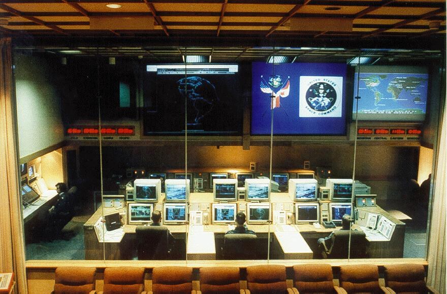
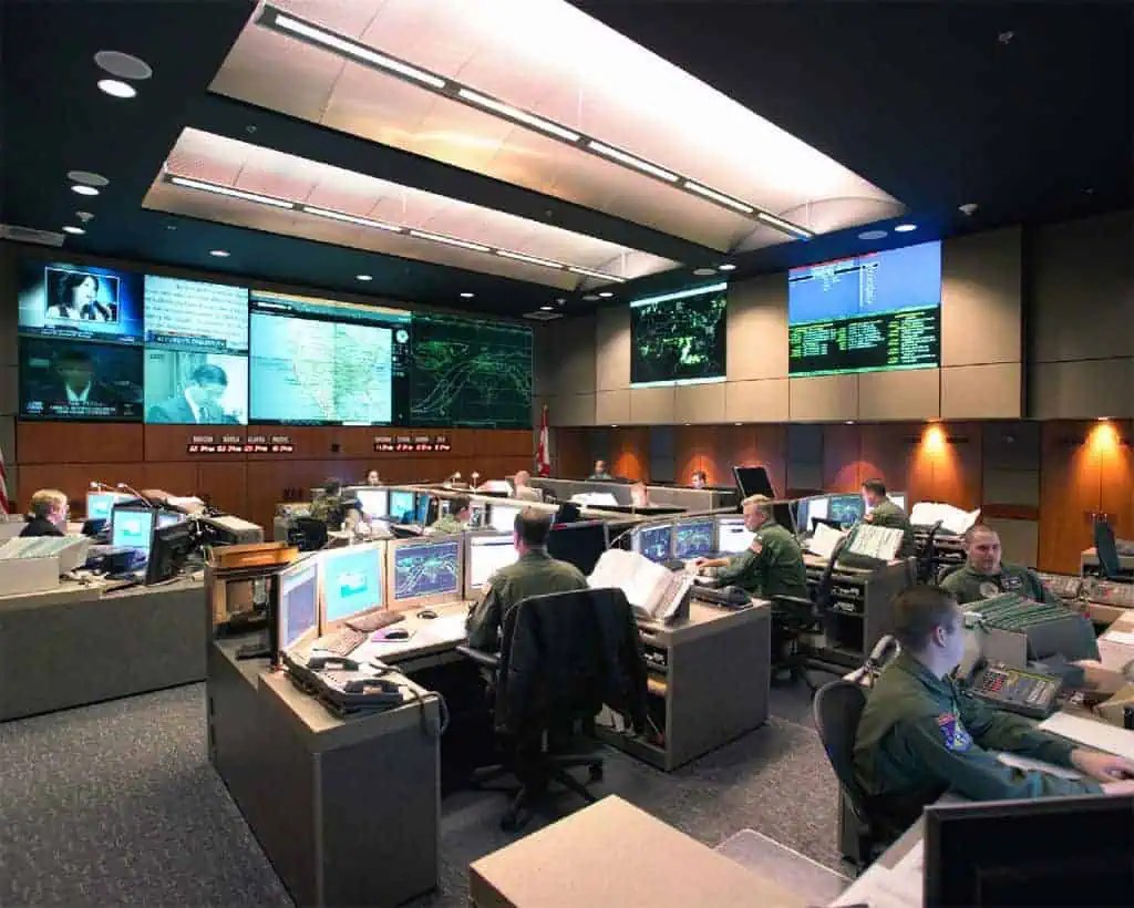
Two photographs of operations centers are included with this article. The older one shows a console room seen through a glass wall, with the U.S. Space Command seal on a large screen and a map display, consistent with the 1990s period of the combined U.S. Space Command and NORAD center. The newer shows a modern operations floor with a video wall and rows of consoles. The captions say what each shows and no more. Neither is dated or labeled in the files I received.
THE SENSORS THAT FEED THE MOUNTAIN
The mountain is not a sensor. It is the place where sensors are correlated, and its survivability would be useless without the sensors that reach it. The sensor families that are publicly known are:
These are the American counterparts to the Russian early warning chain described on this site: Dnepr, Voronezh and the Solnechnogorsk SPRN center. The structure is similar: radars and satellites feeding a central assessment center that tells the leadership whether an attack is real. A well-known example of how that works from the other side is the 25 January 1995 incident, when a Norwegian-American scientific sounding rocket launched from Andoya was initially mistaken by Russian warning systems for a possible missile. According to public reports, NORAD and U.S. officials had been told of the launch in advance by Norway, while the notice did not reach the right Russian people in time, and the Russian president was shown the "Cheget" briefcase. The incident ended without escalation. This is widely reported and I have not verified the details beyond that general account.
COMMUNICATIONS IN DEPTH
A command post without communications is a cave. The public record on the mountain's communications is thinner than on its construction, because the links are part of nuclear command, control and communications (NC3), which is classified in detail. What follows is what has been published, with the physics that explains why each path exists.
What the mountain must send and receive
Inbound: sensor data (missile warning messages, radar tracks, satellite detections, nuclear detonation reports) and queries from the National Military Command Center, the alternate command centers, the Canadian command centers and the allies. Outbound: warning and assessment to national leaders; tactical warning to forces; and coordination with air defense, space and strategic forces. The mountain does not issue nuclear launch orders. The authority to order a nuclear strike rests with the President, and the mountain's job is warning and assessment, so that the President and the senior staff can decide. Orders travel from the President through the National Military Command Center or its alternates to U.S. Strategic Command and then to the forces. The details of that path are classified and I do not claim to know them. One thing that sources do say is that the mountain's security forces protect "nuclear command and control communications capabilities".
Redundancy: many media at once
The key design principle is that no single medium is trusted. Different media fail in different ways, and a nuclear attack degrades each of them differently, so the mountain used several simultaneously. The published example is the Survivable Communications Integration System (SCIS). A GAO report of July 1992 (IMTEC-92-61BR) describes it as an automated system that would process missile attack warning messages and send them simultaneously over different media to national decision makers. At the time, warning messages could be sent over only one of two media at once: commercial high-speed telephone lines or the Jam Resistant Secure Communications (JRSC) satellite system (built on the Defense Satellite Communications System). The problem the GAO describes is that a message could not go by both at the same time. SCIS was meant to send over many media at once, which increases the likelihood that attack messages arrive even if one or more media fail. SCIS was approved by Congress in 1986, ran 65 percent over its budget (from $142 million to $234 million) and three years late. A later GAO report on Milstar notes that the satellite system was planned as another path for the missile warning network and that its reliability had not been proven.
Why each medium matters, physically:
The 1960s to 1990s airborne and rocket layers
The ground network was supplemented by systems that did not depend on any ground site:
These were not part of the mountain, but they show where it sat in the larger system. The mountain gave warning; the airborne and rocket layers were the means of making sure that an order could still be delivered after an attack.
Civil warning
Another function that ran through the mountain was civil defense warning. The National Civil Defense Warning Center was in the mountain by January 1967, and the mountain later hosted FEMA and Air Weather Service elements. The public alerting systems are covered in the site's US EAS / IPAWS article.
HFGCS: THE HIGH FREQUENCY GLOBAL COMMUNICATIONS SYSTEM
The HFGCS is the U.S. Department of Defense's worldwide high-power HF command net, used when satellite paths are unavailable or denied. It was formerly called the Global High Frequency System and was renamed on 1 October 2002. The equipment is called SCOPE Command. It is a ring of about thirteen fixed stations on four continents and several islands, keyed remotely from two network control stations: Joint Base Andrews in Maryland and Grand Forks Air Force Base in North Dakota. Offutt Air Force Base in Nebraska is a transmit and receive site and is sometimes described as a backup. The system's customers, according to the Air Combat Command fact sheet, include the President, U.S. Strategic Command, USNORTHCOM and the National Command Authority. The companion page on this site, USAF HFGCS, holds the published voice and ALE frequencies.
Here is how it fits with the mountain. The mountain detects and assesses. It reports to national authorities. The national authorities decide. Orders to the forces then go out over whatever is available, and HFGCS is one of the layers. It carries one-way Emergency Action Messages (EAMs) in a standard format: a string of characters, repeated, that are encrypted and that the forces that receive them authenticate and decode. The best-known open description is the two-way traffic of aircraft check-ins, phone patches to the DSN and test counts at shift changes. What listeners can and cannot know is described on the HFGCS page: open monitoring can log that an EAM went out, its length and the frequencies used, but it cannot read the encrypted content. I could not find any public source that says what traffic travels between the mountain and HFGCS stations, and I will not make up a link diagram. The sensible, supported statement is that HFGCS is one of several layers of the nuclear command network, which also uses satellites, VLF, airborne relays and cable, and that the mountain is one of the places that depends on that network.
The physics of why HF is useful here is simple. At HF a signal is refracted by the ionosphere's F layer (electron density of order 10 to the 12th per cubic metre, a plasma frequency of about 9 sqrt(N) hertz, or roughly 9 MHz) and returns to Earth hundreds to thousands of kilometres away. By using several frequencies at once, a net can find one that works whatever the time of day or solar conditions. After a nuclear burst, the D layer of the ionosphere is ionized, and absorption (which varies roughly as the inverse square of the frequency) blacks out the lower HF channels for a while, while higher HF channels recover sooner. That is why the net uses multiple frequencies across the band and why automatic link establishment, described in the ALE article, tests the channels and selects the best one. HF antennas are simple, cheap and easy to rebuild, and a transmitter can be dispersed and made mobile. The cost is a low data rate and fading.
BACKUP POWER AND COOLING
Electricity powers the computers, the air plant, the pumps and the lights, and nearly all of it becomes heat. A hardened site has to supply both.
What is published
How long could it run? (my estimates)
The fuel figure lets you check the claim of "weeks". Diesel contains about 38.6 megajoules per litre. 510,000 US gallons is about 1.93 million litres, or about 7.5 times 10 to the 13th joules of chemical energy. At 35 percent generator efficiency that is about 2.6 times 10 to the 13th joules of electricity, or about 7.3 gigawatt-hours. If the whole backup plant ran at its 10.5 MW nameplate, that would last about 29 days. At a more realistic average load of 3 MW it would last about 100 days. Standard fuel consumption of a large diesel is about 0.07 gallons per kilowatt-hour at good load, which gives roughly 700 gallons an hour for six generators at full output, so about 700 hours, again about a month. These numbers use the unconfirmed 510,000-gallon figure and the nameplate ratings and are only a plausibility check. They match the public statement that the complex could operate for "weeks" when sealed off, which is what the official descriptions say.
Heat is the other limit. The reservoirs are a thermal store. The Wikipedia article, quoting an Air Force description, gives a 4.5-million-gallon reservoir used as a heat sink. That is about 17,000 cubic metres, or 17 million kg of water. Heating it by 20 kelvin absorbs 17 million x 4,186 x 20, about 1.4 times 10 to the 12th joules. If the heat load were 5 MW, the reservoir would absorb it for about 79 hours before it had warmed by 20 degrees; at 2 MW it would last about 8 days. The real heat load is not public, and the real arrangement (one reservoir or three, how much cooling can be done by the towers) is uncertain, so this only shows why a large body of water is a sensible way to buy time. The cooling towers depend on moving air and are the less survivable part, which is presumably why the closed loop can fall back on the reservoirs.
WATER, LIFE SUPPORT AND PEOPLE
Water
Water comes mostly from the mountain itself. A federal permit statement says "water used in the underground complex normally comes from internal springs and water seepage into the reservoirs and for many years there has been more water than is needed", and that water sometimes seeps from the walls and ceilings and drains to the floor. A design description says 30,000 to 120,000 gallons a day is collected in four excavated reservoirs: three for industrial use and one as the main domestic source, each able to hold 1.5 million gallons. The Denver Post infographic says four reservoirs "can hold up to 6 million gallons". An Air Force tour article says the three reservoirs it saw (diesel, drinking and industrial) store more than 4.5 million gallons between them, and the CNET article gives a 1.5-million-gallon domestic reservoir and a 4.5-million-gallon heat-sink reservoir. These figures cannot all be right at once, and they probably describe different counts and different dates. A fair summary is a drinking-water reservoir of about 1.5 million gallons, additional industrial and cooling reservoirs bringing the total water storage to several million gallons, and a separate diesel reservoir.
The drinking water is chlorinated in the mountain. A person needs about 2 to 4 litres a day to drink and of the order of 100 litres a day for everything with normal use; 1.5 million gallons (5.7 million litres) is a large margin for several hundred people for weeks, even before counting the continuing spring inflow.
Food, medicine and comfort
The complex was designed to be self-sufficient, with space devoted to support functions: a dining facility, a medical facility with a dental office, a pharmacy and a two-bed ward, fitness centers, a small exchange, a chapel and a barber shop in the older description. B17 News and others mention food storage; no public figure for the amount is given. Cots for most personnel and suites for senior officers are described.
Crew capacity
The standing population is about 350 to 580 people (the 2016 figure of 350 to 580 working in the mountain at a given time is from an Air Force-related source; the 2024 permit document says about 350). I could not find an official figure for the number of people that could be sheltered. The design requirement was "limited, but adequate, sleeping facilities" for "button-up" exercises and emergencies. The Air Force's description of a floor space "full" in 2016 suggests the more interesting constraint today is office space and not shelter space.
THE SECURITY PICTURE
A site like this is hard to hit and not hard to find. The Soviet Union knew where it was. Some Wikipedia text quotes a memoir saying that variants of the R-36 with a single 18 to 25 megaton warhead were targeted at complexes such as this one. That statement is a secondhand recollection and I have not verified it. What is solid is the logic. If you cannot hide a target, you make it hard to kill, and you make the attacker spend many warheads on it. The point of a hardened command post in a deterrence strategy is that it forces an attacker to use a number of large, accurate warheads (a ground burst with two or more weapons might be needed to have a good chance of defeating it) and to accept that the consequences of such an attack are certain retaliation.
Hardness is also relative to accuracy. The hardness of a target is expressed by the overpressure it can withstand, and the number of warheads needed depends on weapon yield and circular error probable. As Soviet missile accuracy improved through the 1970s and 1980s, the 1.5 nautical mile design standard from the early 1960s mattered less in the sense that a more accurate weapon could land much closer. The 2008 move of day-to-day operations to Peterson Space Force Base reflected the judgment that a surprise ICBM strike was now a lower probability than it had been, not that the physics had changed.
COMPARISON WITH SOVIET AND RUSSIAN SITES
Perimeter and the Russian approach
The two sides chose opposite philosophies. Cheyenne Mountain is a known address with a public history, tours (until recently), a fact sheet and an operations center that has been photographed many times. The Russian counterparts are mostly a matter of reports and claims. The Perimeter system (Dead Hand) has a command missile and a crisis-mode logic that watches for attack, and a deep command post that some sources, notably Ron Rosenbaum in Slate in 2007, place under Kosvinsky Kamen in the northern Urals. Russia has never confirmed that location, but a September 2026 investigation by Danwatch, the Dossier Center and The Sunday Times documented a large underground complex there, Object 1335 (Grot), run by military unit 20003. See Object 1335 (Grot) for what is documented and what is not. Russian practice of publicizing a cover name or a nearby landmark instead of the real site (Baikonur is the standard example) means it could be a name for another place. Mount Yamantau in the southern Urals (the Mezhgorye area) is another site that Western reporting has linked to deep Russian underground construction, again without confirmation. The Wikipedia article on Cheyenne Mountain lists both as "potential Soviet/Russian counterparts". I would treat both as unverified.
What is documented is the system around them. The primary Russian command chain uses Kazbek and the Cheget briefcase, described in the Russian C3 and National Defence Management Center articles. The early warning chain consists of the Dnepr and Voronezh radars and the Solnechnogorsk center, which tell the leadership whether an attack is real. And Perimeter was designed to deliver a launch order even if the normal chain was destroyed.
The structural difference
The American design put the survivable element in a fixed, hardened, well-known place and added redundancy around it: airborne command posts, rockets, many media. The Russian system emphasized a dormant, automatic or semi-automatic retaliation circuit and a rocket that broadcasts the order, with hidden, deep command posts. The American system tried to make the decision survivable, while the Soviet system tried to make the execution survivable and put the authority transfer in a crisis-mode logic. Each is a reasonable answer to the same problem: a deterrent is credible only if retaliation is certain, and certainty requires that the order can be given and delivered after an attack.
The American design has a point of vulnerability that its builders understood: a single known site. That is why the mountain was never the only site. The airborne command posts (Looking Glass, then E-6B and E-4B), the alternate command centers and the later move to Peterson with the mountain as backup all reflect that.
OTHER U.S. SITES
The U.S. does not tell everything about these sites. Cheyenne Mountain is the most open, partly because its warning function benefits from being known.
DIFFERENCES BETWEEN SOURCES
The public record contradicts itself on several numbers. This is how I handled them.
WHAT IS SOLID AND WHAT IS NOT
What is solid: the location, the 1961 to 1967 construction, the 15 buildings on 1,319 springs, the granite overburden of roughly 2,000 feet, the blast doors and valves, the move of daily operations to Peterson in 2006 to 2008, the status as alternate command center, the 2015 contract and the Missile Warning Center's continued presence in 2026.
What is reported but with numbers that vary: the weight and closing time of the doors, the reservoir sizes, the number of people on site, the design blast.
What the public record does not give: the exact current generator and battery configuration, the frequencies, equipment and routing of the communications, the air plant specification, the damping hardware in the spring system, the shielding effectiveness figures, the measured protection factors, and the shelter capacity. Where this article gives numbers for those, they are my illustrative estimates, labelled as such.
COMMON MISCONCEPTIONS
RELATED ARTICLES
SOURCES AND HOW TO READ THEM
ABOUT THE PHOTOS
The photographs at the top of this page, in order:
IN ONE SENTENCE
The Cheyenne Mountain Complex is the NORAD combat operations center built in granite near Colorado Springs between 1961 and 1967, fifteen steel buildings on 1,319 springs under roughly 2,000 feet of rock behind 25-ton blast doors, with welded steel EMP shielding, its own diesel power, water and air, and many redundant communications paths, which since 2006 to 2008 has served as the alternate command center and the home of the Missile Warning Center while its daily operations run from Peterson Space Force Base.