CHAYKA (Russian: Чайка, “seagull”) is Russia’s ground-based long-range radio navigation system. Older official name: Tropik-2. In technical writing it is also an RSDN (Radiotekhnicheskaya Sistema Dal’ney Navigatsii) of the pulse-phase type.
It is the Soviet/Russian counterpart of American LORAN-C. It is not Alpha (RSDN-20), which is Russia’s VLF counterpart to the old Western Omega system. People mix the two because both are Russian ground radio-nav nets.
CHAYKA gives ships, aircraft, and other users a position from radio pulses sent by tall, high-power land stations. It does not need satellites. That is why it still matters as a backup when GPS or GLONASS is jammed, spoofed, or unavailable.
HOW IT WORKS
The system is hyperbolic, or difference-of-distance. Stations work in groups called chains. Each chain has one master and several slave (secondary) stations. All transmit short pulses on the same carrier, about 100 kHz (long wave). A chain is identified by its Group Repetition Interval (GRI): how often the whole group of pulses repeats. Different chains use different GRIs so a receiver can tell them apart.
A receiver measures the time difference of arrival between the master pulse and each slave pulse. Each time difference traces a hyperbola on the map. Two or more such lines cross at the user’s position.
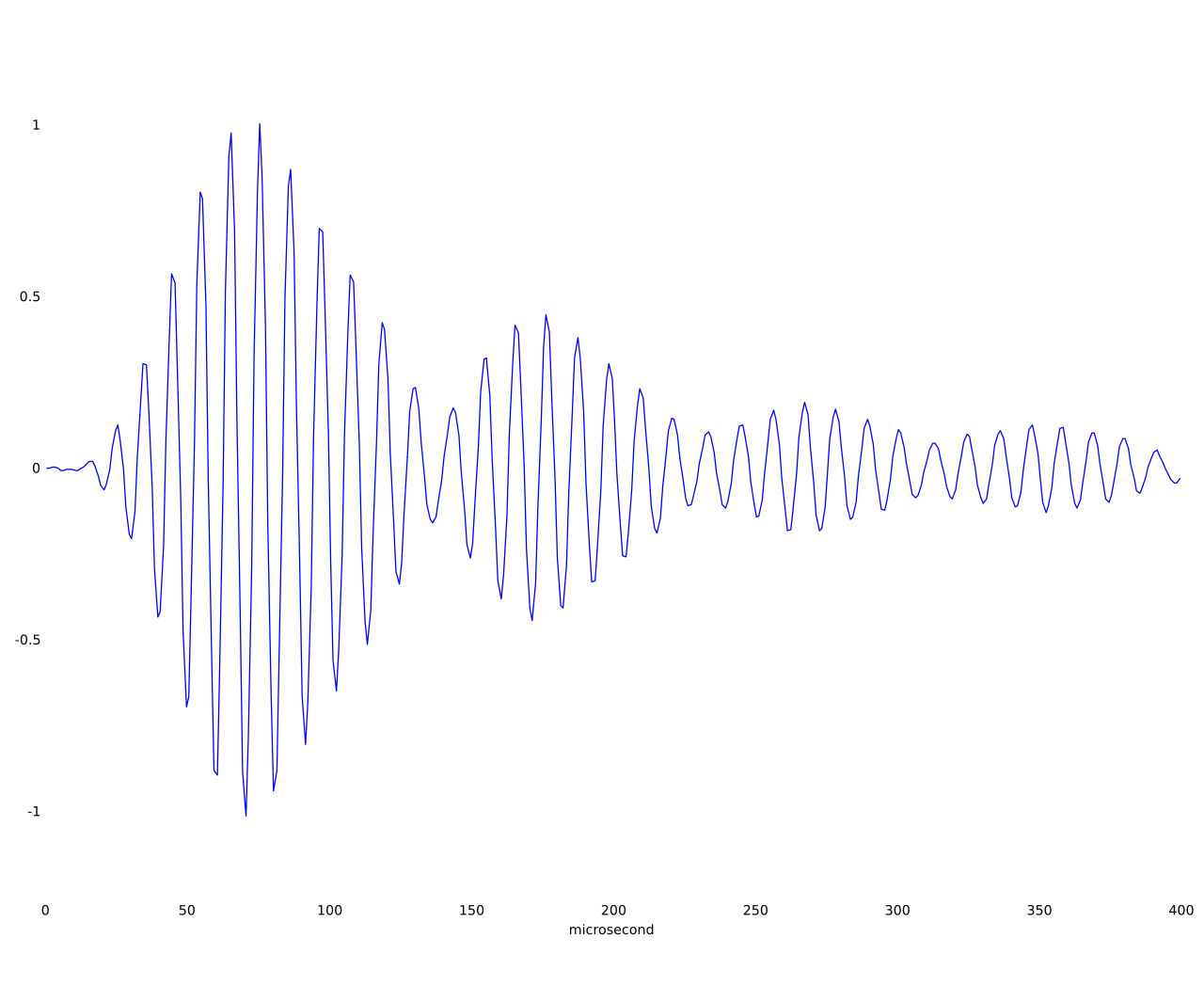
Fine accuracy uses both the envelope of the pulse (coarse timing) and the phase of the 100 kHz wave inside the pulse (fine timing). That is why it is called impulse-phase.
Typical published figures:
Carrier: 100 kHz
Emission bandwidth: about 20 kHz
Pulses in a group: eight navigation pulses, 1,000 microseconds apart
Masters often add a ninth pulse for identification and data
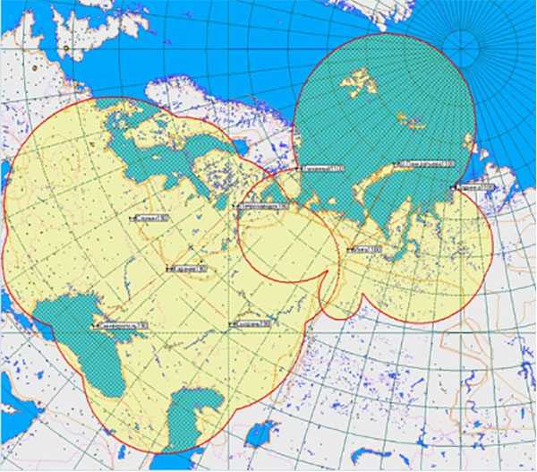
Range over land: roughly 1,400–1,800 km
Range over sea: roughly 1,800–2,000 km
Classic position error: on the order of 50–230 m depending on geometry, skywave, and receiver
With differential / modernized service, claimed errors can drop toward tens of metres in good areas
The signal hugs the ground (groundwave) for hundreds of kilometres. At longer ranges a skywave bounce off the ionosphere appears and can confuse the receiver if it is not filtered.
HISTORY
Work on a Soviet LORAN-class system started in the late 1940s and 1950s for the military, in parallel with U.S. LORAN-C. The service system was developed at LNIRTI in Leningrad. Chief designer: E. S. Poltorak. The Soviet Air Force was an early customer.
The first European chain (RSDN-3/10, Tropik-2, GRI 8000) became operational in 1969. The Far East chain (RSDN-4, Tropik-2V, GRI 7950) was accepted in 1986. Northern chains (RSDN-5) followed in the mid-1990s. The name CHAYKA became common later. The joint Russia–U.S. Bering Sea chain in the 1990s is often cited as when that name stuck internationally.
In 1988 the United States and the USSR agreed to link systems in the North Pacific. A joint CHAYKA / LORAN-C chain (GRI 5980) used Russian stations at Petropavlovsk-Kamchatsky and Alexandrovsk-Sakhalinsky plus the U.S. LORAN-C station on Attu Island, Alaska. That joint chain ended in 2010 when the U.S. Coast Guard shut LORAN-C. Attu went off the air in August 2010.
CHAINS AND STATIONS
Open sources list these main chains. Treat any table as a snapshot.
GRI 8000 — European / Western chain (1969, RSDN-3/10)
Master near Karachev / Bryansk. Slaves historically include Petrozavodsk, Syzran, Slonim (Belarus), and Simferopol (Crimea). Powers often quoted around 450–700 kW.
GRI 7950 — Eastern / Far East chain (1986, RSDN-4)
Master near Alexandrovsk-Sakhalinsky. Other stations: Petropavlovsk-Kamchatsky, Ussuriysk, Okhotsk. The old Iturup station was wrecked by an earthquake in 1994.
GRI 5980 — Russian–American Bering Sea chain (1995–2010)
No longer a joint system after the U.S. shutdown.
GRI 5960 — Northern chain (1996, RSDN-5)
Stations associated with Dudinka, Taymylyr, Pankratiev Island, Inta. Some high-power Arctic transmitters quoted up to about 1,200 kW. Wikipedia notes this chain as no longer in service in at least one listing; Russian sources have been inconsistent.
GRI 4970 — North-Western chain
Uses some of the same northern stations in a second timing pattern.
GRI 5970 and others — regional / mobile
North Caucasus, South Urals, Siberia, Angarsk, Sayan, Transbaikalia, Far East fill-in from lower-power mobile RSDN-10 stations.
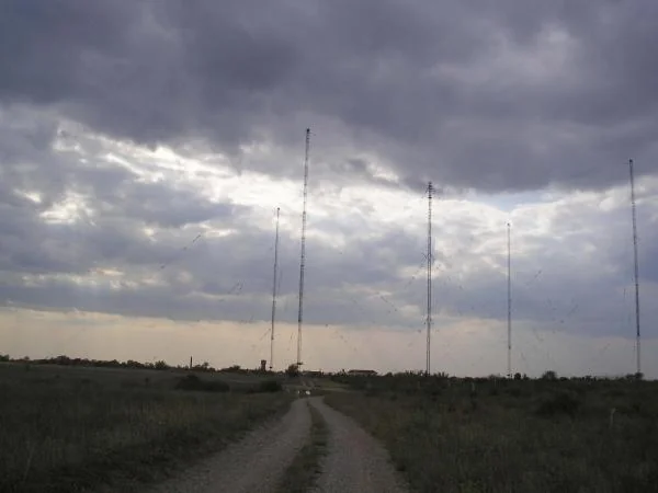
Transmitters are large. Fixed stations use very tall mast antennas, similar in scale to LORAN-C towers. Pulse power at the antenna is often hundreds of kilowatts; some Arctic sites are quoted above a megawatt. Russian standards for modernized stations speak of at least about 600 kW pulse power at the antenna. RSDN-10 is the mobile, lower-power field version used to stand up extra regional chains.
HOW A USER SETS IT UP
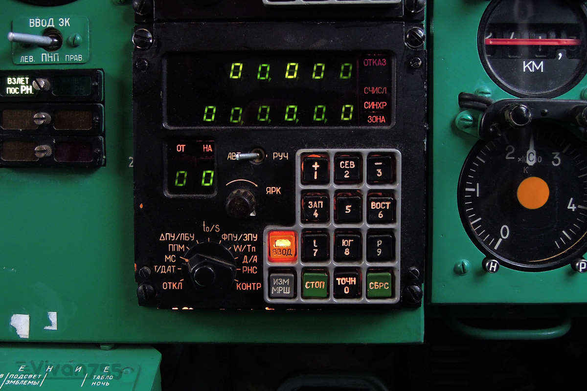
A CHAYKA or dual CHAYKA/LORAN-C receiver selects the GRI of the local chain, locks onto the master group and at least two slaves, measures time differences, and converts those into hyperbolic lines of position, then a lat/long (or uses the time differences directly on a lattice chart). Modern sets may also take GLONASS/GPS and mix the two.
Because the pulse shape and phase coding are close to LORAN-C, many sets can use both. The joint Bering chain needed a pulse front that both communities could track. Pure CHAYKA chains keep the Russian pulse shape; joint or dual-use chains were adjusted toward the LORAN-C shape.
USES
Originally military: aircraft, surface ships, and a terrestrial backup. There was also civilian marine and aviation use, though Soviet/Russian user gear was never as common as Western LORAN sets.
After GPS and GLONASS became normal, CHAYKA was kept as a backup when satellites are jammed, a way to send differential GNSS corrections over the same 100 kHz path (the Russian analogue of Eurofix), a timing source, and coverage in the Arctic and along parts of the Northern Sea Route.
Russian and CIS radio-navigation plans in the 2010s–2020s still talk about integrating CHAYKA with GLONASS rather than throwing the ground net away. Reports during the war in Ukraine have argued that Russian forces can fall back on CHAYKA where satellite PNT is contested. That is plausible — the physics is hard to blanket-jam the way a weak GNSS signal is — but public confirmation of operational wartime use is thin.
STATUS
The United States turned LORAN-C off in 2010. Russia did not turn CHAYKA off.
What remains is a smaller, aging, partly modernized network under the Russian Ministry of Defence, with civilian standards still on the books (GOST R documents for transmitter signals, shipborne receivers, and GNSS correction formats). Not every chain listed in 1990s tables is still live. Cross-border stations (Belarus, Crimea) depend on politics as well as hardware. The Attu link is gone.
The long-term Russian idea is not “CHAYKA instead of GLONASS.” It is “GLONASS plus a hard-to-kill ground system,” sometimes described in eLORAN language: better clocks, solid-state transmitters, GNSS-disciplined timing, and data on the same pulses.
LIMITS
RELATION TO OTHER SYSTEMS
LORAN-C — U.S./NATO cousin; same 100 kHz pulse-phase idea; mostly shut down
eLORAN — modernized LORAN idea; China and others pursue similar paths
Alpha / RSDN-20 — Russian VLF system, Omega-class, much longer range, much coarser accuracy
GLONASS — Russian satellite nav; CHAYKA is the terrestrial backup and correction bearer
MARS-75 — separate Russian coastal/phase system for shipping, not the same net
IN ONE SENTENCE
CHAYKA is Russia’s 100 kHz LORAN-style ground network: chains of high-power towers that give ships and aircraft a position from pulse timing, built from 1969 onward, still kept as a satellite-proof backup even after the West shut LORAN-C down.